Research
The NOAA Oceanic and Atmospheric Research laboratories located across the country engage in pure and applied research, technology development, and services to provide an understanding of Earth's atmosphere, ocean and inland waters, and their interaction with one another to predict and address changes that have environmental and societal impact. To address the threat of tsunami waves along the expanse of U.S. coastline, the NOAA Pacific Marine Environmental Laboratory located in the Pacific Northwest develops products that are used by forecasters as well as emergency managers, civic planners, and engineers to protect coastal populations and infrastructure from tsunami impact. Efforts include the adaptation of technologies to improve tsunami sensing and advance the understanding of tsunami hazards through ever-broadened areas of investigation. New hardware and software capabilities are under development to speed up forecasts of tsunami arrival times, wave height, and current speed and to support community preparedness and mitigation efforts:
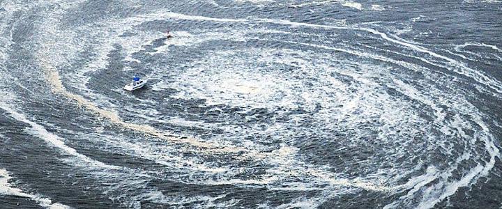
New technologies incorporated into the network of Deep-ocean Assessment and Reporting of Tsunami (DART) systems continually improve detection and reporting of tsunami waves in the deep ocean. National Weather Service Tsunami Warning Centers use DART measurements along with seismic networks to rapidly identify tsunami-causing earthquakes. As tsunami waves move across the ocean and pass over a DART, the paired surface buoy reports actual tsunami measurements from the ocean bottom to the Centers. Computers with Graphical Processing Units (GPU) technology combine these real data with hydrodynamic models to quickly forecast tsunami arrival times, flooding, and currents along U.S. coastlines.
In collaboration with NASA, PMEL is working to improve accuracy and timeliness of tsunami forecasts by combining data from Global Navigation Satellite System with measurements of passing tsunami waves from a sensor on the seafloor.
Simulated flooding and harbor currents from past tsunamis and from those that might one day be generated are used to produce a suite of products, including flooding and evacuation maps, that emergency managers rely on for planning in advance of an active tsunami. For example, tsunami amplitudes modeled from a hypothetical magnitude 9.0 rupture of the Cascadia subduction zone provide planners in Oregon and Washington with a worst case scenario.
For more information the PMEL tsunami research component of the TOAA Tsunami Program, please visit: https://nctr.pmel.noaa.gov.