Tsunami Detection
DART® technology was developed to detect and measure tsunami waves in the deep ocean for the purpose of increasing scientific understanding of their generation and propagation, and for improving forecasts of their impact along vulnerable coastlines. The NOAA National Weather Service (NWS) National Data Buoy Center (NDBC) owns, operates, and maintains a network of 39 DART systems strategically located in open ocean waters throughout the Pacific, Atlantic, and Caribbean basins to measure and transmit water level variations as tsunami waves pass. Transmissions from these systems during an event provide NOAA's two tsunami warning centers with direct measurements that are critical for threat evaluation and forecasting in advance of tsunami impact. In combination with coastal sea level measurements from tide gauges, these data are used post-event to improve numerical models for forecasting and hazard assessment. Hazard assessment is especially important for state-level development of planning and mitigation products such as evacuation maps. From forecasting to community preparedness, DART data are applied to all efforts engaged in by the NOAA Tsunami Program.
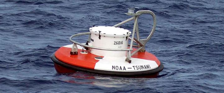
Each DART® system consists of a bottom pressure recorder (BPR) that is anchored at the seafloor and a companion moored surface buoy that allows for two-way communication between the BPR and shore. The system has two data reporting modes, standard and event. Standard is the most frequent mode of operation with routine transmission of 240 water level measurements per hour for quality assurance of system function and health. When onboard software detects passage of a tsunami wave, the system switches from standard to event mode reporting. Instead of routine and scheduled data transmission, 15-second values are sent from BPR to shore immediately upon tsunami detection, after which 1-minute averages are sent on an accelerated schedule over a duration of 4 hours or longer if needed. All data sent to shore via surface buoy are derived from a base measure of absolute pressure in units of pounds-per-square-inch [psia]. Software that resides within the BPR corrects measured water column pressure for temperature effects and converts the result to water level height using a constant 670 mm/psia. A full system deployment of 15-second pressure and temperature are stored internal to the BPR and downloaded upon instrument recovery.
Information on DART technology and operations, as well as access to satellite transmitted data is available: https://www.ndbc.noaa.gov/dart/dart.shtml


